MT PULAG, PHILIPPINES
Justin Hawthorne

Summit success up in the clouds.
Choosing just one mountain to climb during a short visit to the Philippines is not an easy task, especially considering the nation is comprised of over 7 100 islands. With Luzon, the largest of the islands, being our main region of travel, we looked at the Philippine Cordillera for our answer. After much research and discussions, Mt Pulag, the third highest peak in the archipelago, was the aim of my girlfriend Katherine, and I.
Travel in the Philippines is not a straightforward task and simply getting to Kabayan, the closest village to our trail jump-off, was a mission in itself. After spending a night in Baguio, a pine-clad town in central Luzon acting as the gateway to the Cordillera, we caught one of the few daily trips to the dead-end village of Kabayan. An arduous journey I can’t deny, but once in Kabayan you appreciate being so far away from the hustle and bustle synonymous with life in Filipino towns. We couldn’t complain about being the only guests, at the only lodge in town. Bordering Mt Pulag National Park the setting of this calm village is spectacular. Terraced farmlands, high mountains, gushing rivers and a peculiar stillness after dark. Securing a guide (a requirement of the National Park) was purely a formality and after a steaming home-cooked meal we hit the hay whilst listening to the rain bucket down on the corrugated roofing.

Looking up at the mountains from Kabayan the day prior to the hike, moments before the rain.
To our relief we awoke to good weather. The rain had dissipated and the sun was burning bright, albeit with cloud lingering. Hiking during typhoon season complicated our climb and rain was a constant threat. The jump-off for the Akiki Trail (dubbed the Killer Trail by Filipinos) was just a short tricycle ride out of the village and we were on our way after signing in at the ranger’s office.

Akiki Jump-off point.
The trail ascends steeply passing houses and small farms before reaching the slopes covered in Benguet Pine (Pinus kesiya). We passed by an old Ibaloi1 burial site in a ravine where human skeletons were visible from the path, and not too long after reached the Eddet River where we refuelled and listened to the water cascading over the rocks. The burial sites are located in the mountains, typically caves and overhangs, to allow the dead to watch over their relatives, or so we were told.

Eddet River.
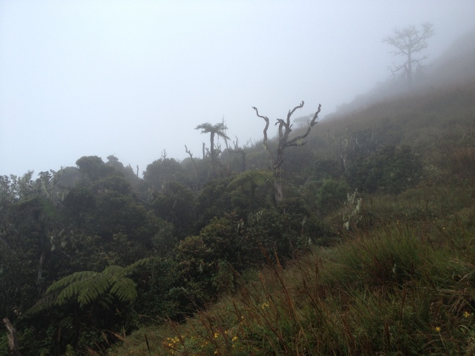
Hiking beneath the towering pines was other-worldly and soon we began entering the cloud zone. As the visibility decreased with the cloud, the serenity of being in such a quiet place was special. We rested from time to time and simply stood hearing nothing other than the air being sucked into our burning lungs.

Ascending through clouded pines.
Three hours of relentless hiking through this spectacular forest brought us to the Marlboro Country campsite. As we were hiking in thick cloud, no view was afforded to us so I cannot vouch for its likeness to the old Marlboro ads from whence it takes its name. In the process of having our afternoon snack the first drops of rain began falling. Rain gear went on and for our guide this simply meant draping his poncho over his head. This is more than the average guide uses – the norm being an umbrella – hitting home the fact that we were in for a tough time.2

Surrounded by towering pines.
Just before setting off a farmer kitted out with his gumboots, umbrella and hoe, came cruising down the path into camp. Our guide had a brief chat and informed us that the farmer had descended from the saddle camp, passing not a soul. It was evident the farmer was preparing the path for an easier passage for his livestock, the Carabao (water buffalo). The muddy path had fresh steps cut into it making for simpler walking, not only for his Carabao! The National Park is open access and as a result farmers pass through with their livestock using the many paths on a daily basis. Erosion and constant ‘path maintenance’ by the farmers won’t do the existing hiking trails any good. On top of this, illegal logging of pines and montane forest trees takes place. Regulation of these activities appeared to be challenging considering the topography and location. I personally hope for the best that the Park is preserved as best as possible as it is a beautiful part of the country.
Exiting the lush rain forest in…rain.
Our pagan guide said his prayers before we entered the dark montane forest, continuing our ascent in the rain. Hours later we emerged to a gusty grassland and slogged slowly across the undulating terrain. The temperature had dropped significantly and together with the strong wind, rain and our wet-in-places bodies made this final section a little nasty. The sight of the saddle camp was a relief as sunset was only a few minutes away. There was no campfire, no late night chatting, no watching the sun go down. There was, however, an immediate change into thermals, gobbling down supper and crawling into sleeping bags.

Ascending via a mystical forest.
We prepared to rise at daybreak and head to the summit, which lies 20 minutes away, in the event that there was a break in the weather. Unfortunately we awoke to a cloud-smothered mountain as we had left it the previous day. Nonetheless we set off early and summited at 07:33 am on 10 September 2014. Standing atop Mt Pulag at 2 922 m was a memorable occasion for both Kath and I – a personal best for both of us, and we shared the achievement.

A cloudy grassland summit.
We lingered at the peak for quite some time, absorbing the atmosphere and catching glimpses of what lay in the distance as the clouds opened every once in a while. From the summit we saw our farmer friend go marching on in the distance with his Carabao in tow.

Katherine just below the summit with the approach route visible.
The descent we undertook was via the relatively straightforward Ambangeg Trail, the easiest and most popular access to the summit. Nearing the montane forest line the rain once again arrived, this time, however, it was in full force. We descended the remainder of the journey in relentless rain, reaching the road back to Kabayan at sunset, just before the final minivan was collecting passengers.

Our guide, Richie, leading the way in his poncho.
The trails through the montane forests are beautiful – tree ferns, mosses and old gnarly trees are a constant. On reaching the National Parks’ Ranger Station we signed out and headed straight to the local store for a hot brew and enjoyed it seated under a tin roof. Due to the heavy rains, the high mountain roads leading to this point were in a bad state, according to the local Jeepney driver.3 We took our guide’s advice and agreed to continue hiking down through the farmlands and villages – a route that would land us nearer to Kabayan. We passed vehicles stuck in the mud and children playing in the rain. We passed fields littered with carrots left to rot and walked along roads now acting as canals.

The muddy roads were not only tough on the vehicles but for us too.
As the day drew on and the descent worsened, Kath’s legs took a hammering. A local man on a motorcycle passed by us and our guide made an enquiry about Kath getting a lift for the remaining few kilometres. Thankfully he agreed and she reached the end point safely. From her account the ride down the steep winding roads in the rain was the worst part of the journey and I can understand why. The high mountain roads were taking a beating due to the rain and their current state was horrendous in places. By the time I reached the junction, reuniting with my hiking partner, the sun had just set and my legs were wobbling, feet screaming to dry off and warm up. We had both climbed the peak without much fuss, the knee-jarring descent was another demon altogether. We conquered the so-called “Killer Trail” and have informally given that name to the route we descended! The trail was a wonderful journey and hiking in challenging weather conditions made it just that bit more notable. Arriving back at the homestay in darkness and after washing up using a hand-bucket shower, Kath and I sat down for a steaming home-cooked meal.

Mt Pulag summit panorama.
1The indigenous people of the province of Benguet.
2We have summited mountains and done treks in other regions of the country.
3A Jeepney is the iconic mode of public transport for the Philippines, a result of US military jeeps left behind after WW2.
*This article was originally written for the Mountain Club of South Africa.
